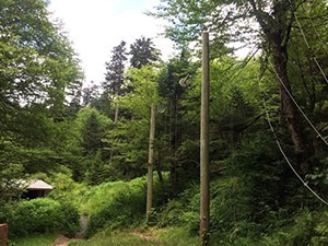
After traversing its lower section three times, I dreamed for the next three years of finally hiking the upper section of Balsam Mountain Trail. I finally got my chance this past July.
With more than a few obstacles between you and either end of this trail, Balsam Mountain is one of those you-can’t-get-there-from-here places in the Smokies. You can start at the bottom, or the end that intersects with Balsam Mountain Road, as long as you plan your trip when the one-way road is open. Oh, and just finding this road can be a challenge, considering its access is off the Blue Ridge Parkway just a little ways from Soco Gap heading toward Cherokee and the Great Smoky Mountains. Confused yet?
But it was the upper section I was after. I’d already been from Balsam Mountain Road to Laurel Gap once, and from Beech Gap to Laurel Gap once, and from Gunter Fork to Balsam Mountain Road. Spend that kind of time on a single trail, even one as magical as Balsam Mountain, and the thought of going back again can be a little daunting.
Thank goodness for friends who invite you along on their over-night, get-away-from-my-cell-phone shelter adventure. My plan was to spend one day and a night sitting around a campfire with them at Laurel Gap, then set off on my own toward the Appalachian Trail, just 12 miles round trip from the shelter, the next morning.
Twelve miles sounds like a long way until you look at the no-heart-beat elevation line included with its description written by William “Bill” Hart in Hiking Trails of the Smokies. Most other routes to the AT in the Smokies, whether on foot or behind a steering wheel, require a heart-pumping, butt-kicking climb to reach this famed trail. Not this one. That flat-line elevation chart gave me the most hope that I could complete the 12 miles and still get off the trail another 4 miles away before dark.

If you enjoy long mountain views to your left and right, the upper section of Balsam Mountain is for you. Perhaps because it’s nearly level or because it’s hard to get to, this section of trail is in great shape. At the height of summer the path was somewhat overgrown in the sunny spots, but nothing that couldn’t be pushed through easily enough. After a leisurely lunch at Tricorner Shelter, I filled my water bladder and headed back the way I’d come, with thoughts of a warm shower and a soft bed pulling me back to my car.
If you go: Balsam Mountain Road is closed most of the year. Be sure to check its status if you plan to start your hike from the bottom. From Cosby Campground, Snake Den Ridge intersects with the AT about 3.7 miles from Balsam Mountain.
Subscribe to get the latest posts sent to your email.
The Great Smokies Welcome Center is located on U.S. 321 in Townsend, TN, 2 miles from the west entrance to Great Smoky Mountains National Park. Visitors can get information about things to see and do in and around the national park and shop from a wide selection of books, gifts, and other Smokies merchandise. Daily, weekly, and annual parking tags for the national park are also available.