


Twenty years ago, the map room in Great Smoky Mountains National Park might have been dedicated to heavy, flat-file drawer cabinets—each one filled with stacks of intricately detailed maps of the mountains. These days, the room is much more spartan.
Gone are many of the paper maps and heavy cabinets. In their place is a relatively modest bank of monitors connected to a heavy-duty processing system in the northeast corner of the Twin Creeks Science and Education Center.
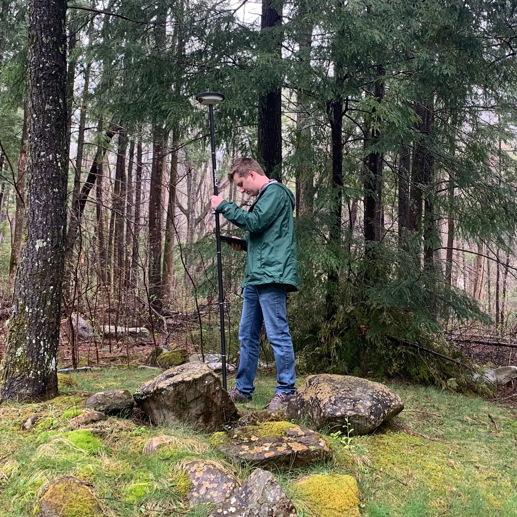
At the helm of this workstation is GIS Specialist Tom Colson, whose role is to harness the research and data collected by other park service departments, embed that information directly onto the digital contours of the Smokies, and facilitate its use and open sharing. The detail-rich map layers and tools that Colson creates and manages are made instantly accessible to NPS staff working on the ground and remote researchers anywhere in the world.
GIS, or geographic information systems, are applications used for making maps at their most basic level. But the complexity of what is involved and possible within contemporary GIS in terms of data analyses, modeling, and interactive querying is hard to overstate. Instead, Colson opts for understatement: “Someone in this park has a job to do. There’s a service to provide based on their location. And we provide that service.”
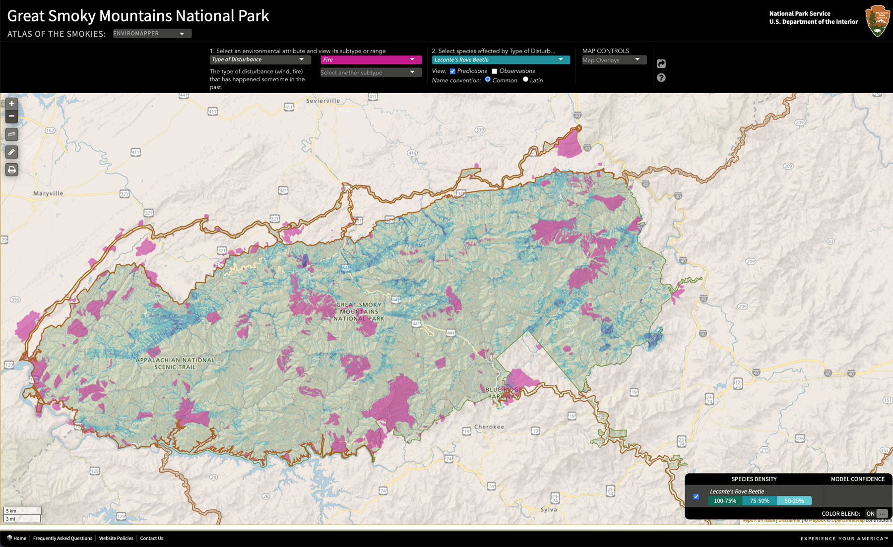
Colson’s summary only begins to hint at the number of ways the services rendered by GIS have become central to virtually every scientific team working in the Smokies. Through the free online GSMNP GIS portal, which hosts more than 1,000 downloads a week, the many varied data sets collected in the park over decades come to life in bright, colorful layers.
The result is mountains of fascinating details: Blue veins trace mountain stream hydrology, fish population distributions, and acid deposition levels. Deep greens track vegetation. Browns and teals map the locations of exotic species to be managed. Dusty oranges and reds reflect gradations of soil and vegetation burn severity from the Chimney Tops 2 fire. Ecoregions, critical habitats, and areas of elevated light and noise pollution are all carefully highlighted and set apart.
Still more maps look into the future, depicting projected losses of forest cover, areas of potential erosion, even travel time from public roads to various sections of the park in the event of an emergency. The Atlas of the Smokies uses GIS to lay out the distribution of species based on observations in the park.
Looking at this variety and the granular detail contained within the GIS archives, the real-time impact of the coordinated scientific research that passes through Twin Creeks becomes as clear as a bright green boundary line. Research and hard work in the field is translated, through the exacting and technical work of GIS, into faster search-and-rescue operation on the ground, more efficient management of invasive species, and better conservation of critically endangered species endemic to the Smokies.
What’s more, GIS layers and data sets can be overlaid on one another and compared, creating problem-solving shortcuts when it comes to investigating causes and effects in the natural world. For example, critical habitats for threatened bats might be compared to areas with noise and light pollution. Areas of excess noise and light pollution can be correlated with their impacts on wildlife, or zones of higher fire risk can be overlaid on travel time from major roads to help determine the best solutions for worst-case scenarios. The infinitely interactive nature of GIS means there are infinite possibilities for its use.
“What’s unique about GIS is that it used to be a very niche field. Five years ago, if you wanted to make a map, you had to physically come walk into this office and request the map. And you’d get one in two to four weeks,” said Colson. “Now what we build are systems and solutions so people can make their own maps.”
As for the future, Colson believes the GIS department has plenty of work left to do in the park, from specific research and planning projects to day-to-day upkeep.
“As technology marches forward, it requires more complexity—it requires more administration,” he said. “It requires more advanced troubleshooting skills, storage, bandwidth, memory, you name it.”
Whether it’s carefully orchestrating infrastructure upgrades or creating a plan to protect fragile native species, most jobs in the Smokies inevitably depend on having a reliable roadmap. For all such vital groundwork in the park, the park’s GIS office is the first port of call—a buzzing hub that plots the latest data points into a picture of the Smokies that gets a little clearer every day.
Subscribe to get the latest posts sent to your email.