The scenic drives in the Smokies can introduce you to plenty of wildlife, rushing streams, colorful flowers, lush forests, mountain vistas, and historic buildings—all from the seat of your car. To get the full flavor of the Smokies, be sure to park in plenty of the many pull-offs so you can get out and explore on foot as well.
This is the seventh in a series of blog posts describing the park’s best scenic drives.
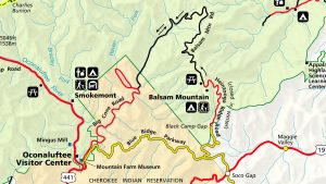
This 47-mile loop drive (which is closed in winter, starting November 1) actually involves a number of roads, both in and out of the national park, at some rather high elevations with stunning views. It’s also one of the best drives for summer wildflowers. Part of the road is gravel, but it’s fairly easy to navigate in a car (although no RVs are allowed). The whole loop takes a little more than two hours, not counting stops.

Start at the Oconaluftee Visitor Center and drive toward Cherokee, North Carolina, for one mile, turning onto the Blue Ridge Parkway near the national park boundary. The great views and many pull offs begin right away—on both sides of the road. Some of the best include the Thomas Divide Overlook (after five miles) and the Big Witch Overlook (after seven miles).
After about 11 miles on the Blue Ridge Parkway, which will take about 20 minutes, turn off at milepost 458, where you will see the big sign for Balsam Mountain. This is actually Heintooga Ridge Road. In a few miles, you’ll cross back into the national park on this windy, scenic route that offers spectacular views on both the right and left.
Fun Fact: A few miles after turning onto Heintooga Ridge Road is the Masonic Monument at Black Camp Gap. The fraternal order of the Masons built this curious-looking obelisk in 1938. The 12-foot-tall structure, nine feet square at its base, is made of 687 stones from most states in the US, plus 41 countries. Stones from all seven continents have been cemented into the structure, which also boasts stones from the Alamo, the Rock of Gibraltar, the White House, and Plymouth Rock.
Eight miles after making the turn, you’ll pass the Balsam Mountain Campground. At about a mile high, this is the highest-elevation campground in the park. Inside the campground is the trailhead for the Balsam Mountain Nature Trail (1.5 miles, round trip), with its gazillion blackberry bushes, providing a sweet treat in summer.

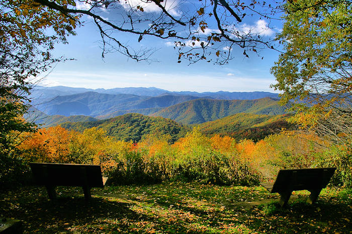
Just half a mile farther, the paved road ends at the Heintooga Picnic Area. This part of the drive, from where you left the Blue Ridge Parkway to the picnic area, will take about 30 minutes. You’ll find restrooms near the parking area and an absolutely spectacular overlook behind the picnic area at the start of the Flat Creek Trail (5.2 miles, round trip).
“There are two benches at the overlook that give you an amazing view of Mount Le Conte and Clingmans Dome,” notes Susan Sachs, education branch coordinator for Great Smoky Mountains National Park. “You can see the whole Smokies ridge line. I love that trail—it’s one of my favorite trails in the park. We always take our out-of-town visitors there.”
Sachs mentions that the trail is great for wildflowers in mid-summer (especially bee balm and sochan, or cutleaf coneflower, which she says are particularly prolific). “The trail passes through an area with a lot of old-growth trees, including an old beech forest,” she adds. “The beech forest has lots of grass growing under the trees. It’s truly otherworldly.”
Back in your car, you could turn around and return the way you came, but to continue the loop drive, turn onto the one-way, gravel Balsam Mountain Road (although the sign reads, “Heintooga-Round Bottom Road”), which follows a narrow-gauge railroad bed from logging days. (Sachs notes that the gate to the gravel road might be closed if maintenance crews haven’t had a chance to remove any downed trees if there’s been a recent storm; any of the visitor centers will be able to tell you if the road is open before you drive out there.)

“This is a real special part of the park,” Sachs says, “especially because there aren’t many other visitors back there.”
The 17-mile drive from here to the dividing line between the park and the Qualla Boundary (home to the Eastern Band of Cherokee Indians) takes about an hour. (The last four of its 17 miles are two-way, and the name here changes to Straight Fork Road.) Where the paved road begins again, you are now outside the park in the Qualla Boundary. A short distance later, the road dead ends at Big Cove Road. Turn left here, towards downtown Cherokee, which is a ten-mile drive.
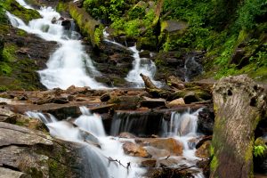
Not quite halfway back to Cherokee, you can stop at Mingo Falls. To get there, cross the small bridge on the left at the sign for Mingo Falls Campground. These pretty falls are 120 feet high, among the highest in the southern Appalachians, and the trail to get there and back is half mile round trip.
Continue on Big Cove Road until it ends at US 441. A left turn will take you into downtown Cherokee, and if you turn right you’ll return to the park entrance and the Oconaluftee Visitor Center.
Fun Fact: Heintooga comes from the Cherokee word Iyentooga, which means hiding place or refuge, or literally, a dwelling in the wilderness. The terrain you see from the overlook at the Heintooga Picnic Area includes the mountains where many Cherokee hid in the 1830s when the United States government forced their trek to Oklahoma, now known as the Trail of Tears.
Subscribe to get the latest posts sent to your email.
The Great Smokies Welcome Center is located on U.S. 321 in Townsend, TN, 2 miles from the west entrance to Great Smoky Mountains National Park. Visitors can get information about things to see and do in and around the national park and shop from a wide selection of books, gifts, and other Smokies merchandise. Daily, weekly, and annual parking tags for the national park are also available.