

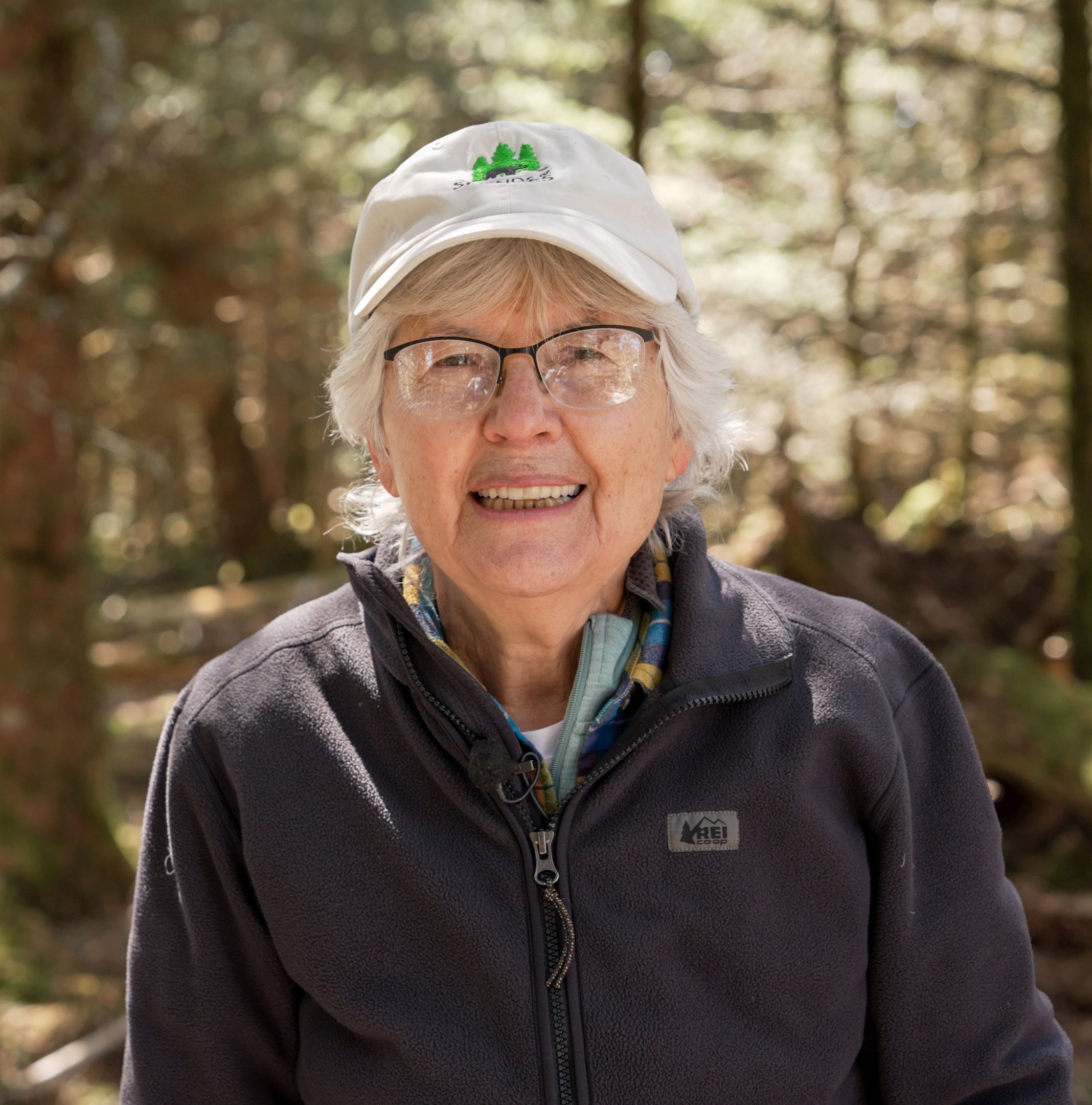
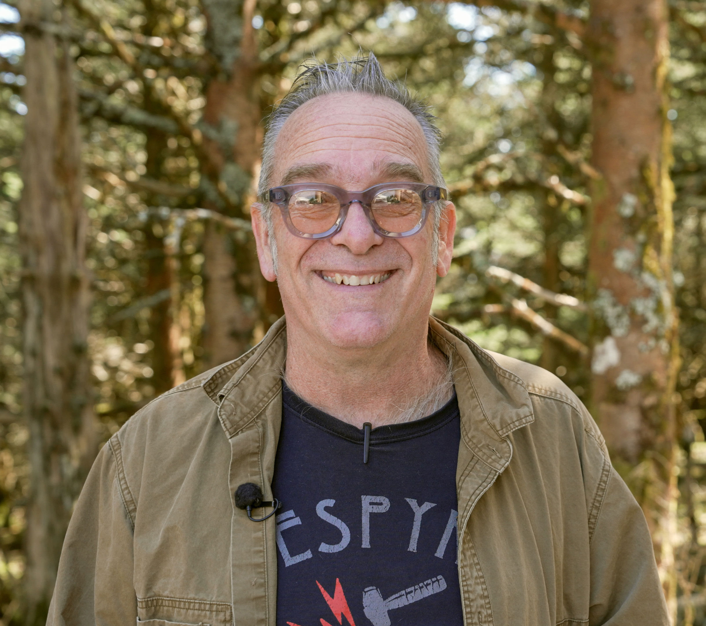
In 2009, Danny Bernstein was looking for a new hiking challenge. Having just finished all 850 miles of trails in Great Smoky Mountains National Park, the Asheville-based hiker and outdoor writer set her sights on completing the Mountains-to-Sea Trail, which stretches across the state of North Carolina from the Great Smoky Mountains to the Atlantic Ocean.
“Of course, we had hiked parts of the MST in the mountains, but where exactly was the western end of the trail?” said Bernstein, who completed it with her friend Sharon McCarthy. “It took us a while to find.”
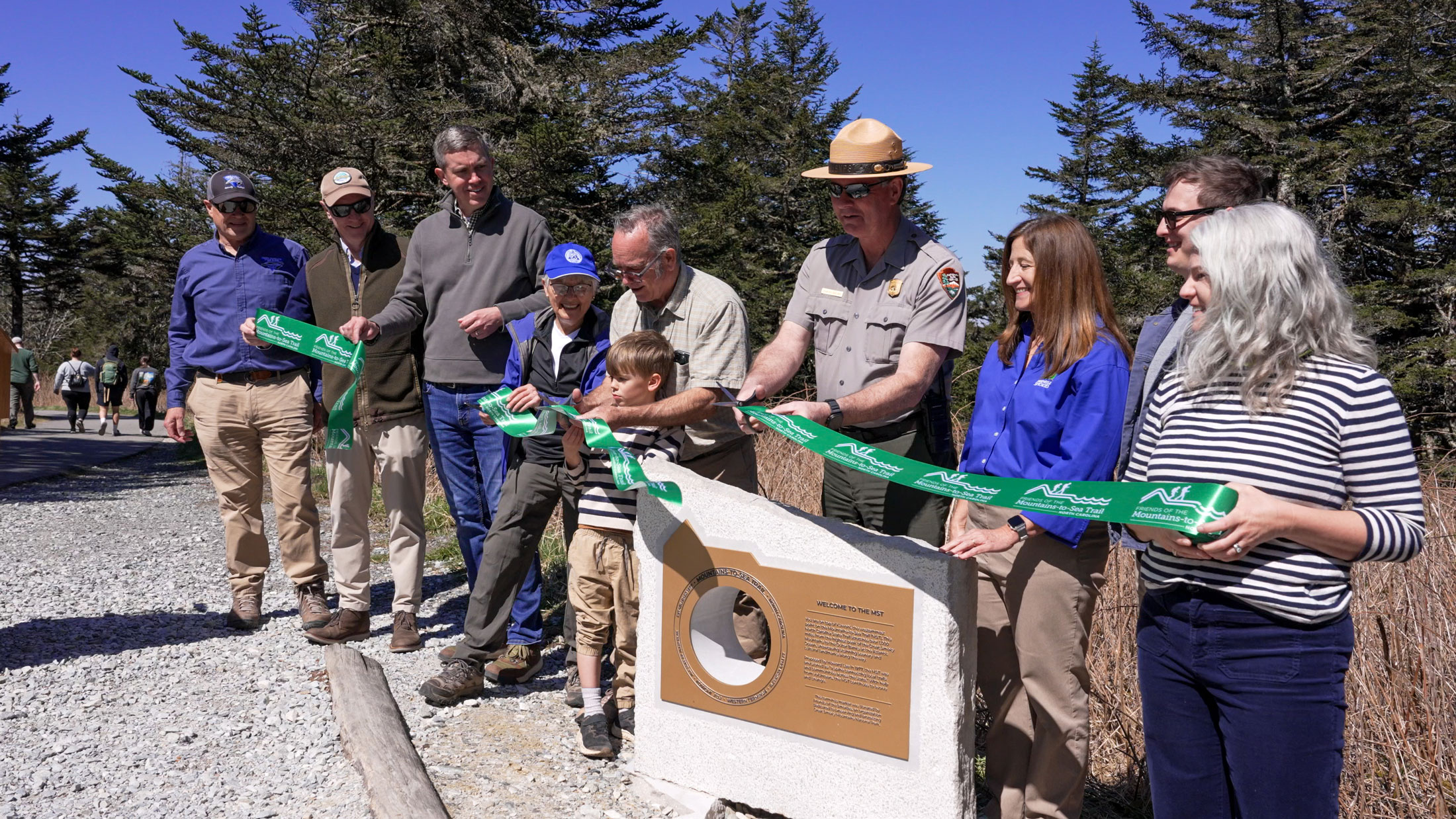
In recent years, Bernstein has made it a personal mission to ensure that future hikers won’t have that problem. These efforts culminated in a ceremony atop Kuwohi on Thursday, April 9. Bernstein was one of several speakers addressing the more than 100 people gathered there for the unveiling of a new stone marker signifying the western terminus of the cross-state trail.
“First and foremost,” said Smokies Superintendent Charles Sellars, who opened the ceremony, “Kuwohi is a sacred place to the Cherokee people. . . . Kuwohi is also the highest point in the Smokies, rising to 6,643 feet, and is a beloved destination for visitors seeking views, recreation, and wonder. And beginning today, Kuwohi takes on another layer of meaning. It is now formally marked as the western terminus of the Mountains-to-Sea Trail.”
Making the marker
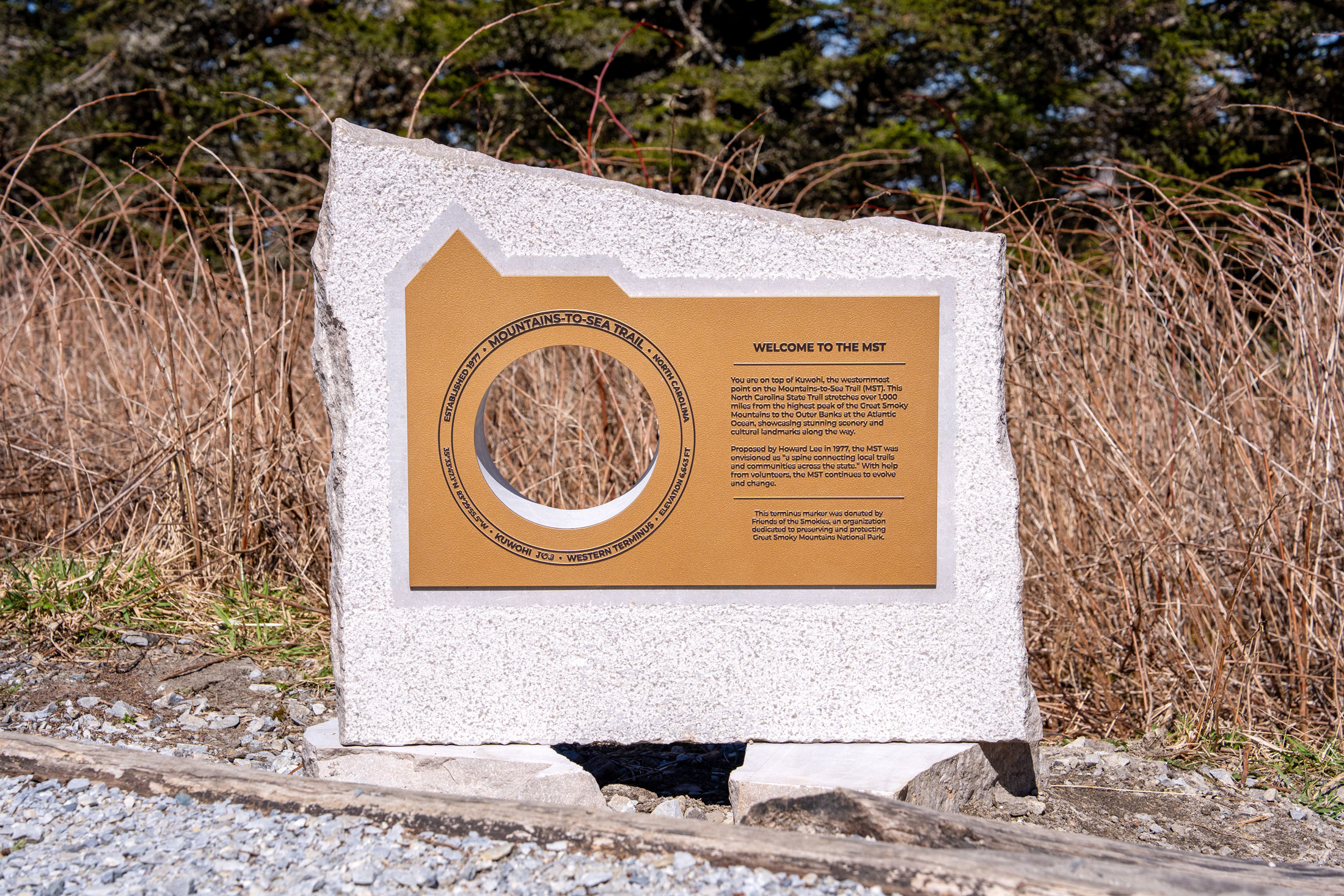
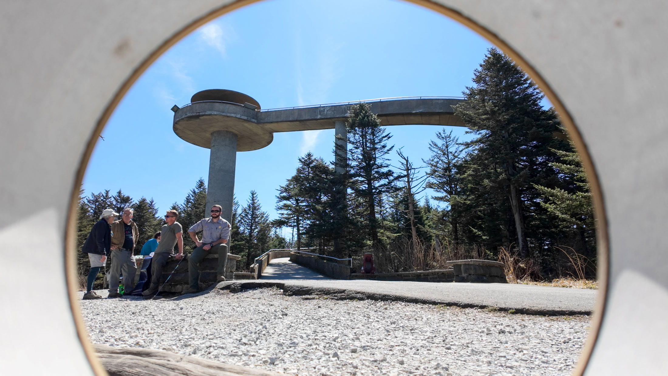
The new marker stands to the side of the paved Kuwohi Tower Trail just before the stone circle at the summit and next to the dirt path connecting to the MST, which initially shares a route with the better-known Appalachian Trail. Created by Knoxville sculptor Preston Farabow, the marker contains design elements referencing the much larger, wooden marker at the trail’s eastern terminus while also evoking a style authentic to the Smokies.
“I felt that an indigenous stone was an appropriate starting point for this end of the trail,” he said, “and after multiple forays through backyard stone fields with Dana [Friends of the Smokies President and CEO Dana Soehn] and anyone else who appreciated the subtle joys found through looking at rocks, I chose Smoky Mountain gray marble, quarried just a few miles from this site.”
As with the eastern terminus marker, the monument features a cutout circle with location and elevation information around the circumference. But it also includes a bronze plaque explaining what the MST is and how it came to be. And, at three feet wide and 40 inches tall, it is quite a bit smaller than its 10-by-11.5-foot counterpart in the Outer Banks.
Though Friends of the MST had intended to eventually install a marker on the western end, Bernstein’s efforts sped up the process considerably. The eastern terminus marker was completed in fall 2023 at Jockey’s Ridge State Park in the Outer Banks, and the organization had other projects to attend to before navigating the complexities of installing a similar marker on federal land. Following Hurricane Helene in September 2024, Friends of the MST faced what Executive Director Brent Laurenz termed the “Herculean task” of reopening hundreds of miles of closed trails. Bernstein was the “driving force” in moving the project forward, coordinating with Friends of the MST, the National Park Service, and Friends of the Smokies to see it through.
“I talked to everyone who had any knowledge on how to get started: retired rangers, friends groups, active Smokies employees,” Bernstein said. “Everybody thought it was a great idea in theory. Dana Soehn, with her vast experience, was my mentor, consultant, and facilitator every step of the way, and helped me with a real action plan, which I followed. All these years working for large companies, I knew hierarchy, and she told me what to do, and I did it.”
Friends of the Smokies funded the project and connected Bernstein with Farabow, who had previously completed a project for the park. His monument commemorating NPS employees killed in the line of duty is located in the Sugarlands area near park headquarters.
“It’s just amazing for me to think that from right here, we can all start our first steps on this journey that takes us from these ancient mountains to the sea and connects us from parks, to forests, to the rivers, and to the communities along the way,” Soehn said. “And I think also a community of people who are disconnecting from their daily walk of life and are now connecting on a walk of a lifetime. The Mountains-to-See Trail is truly a place where countless memories are going to be made.”
Inspiration for adventure
The group of trail enthusiasts and Smokies aficionados who applauded the unveiling had a standing familiarity with the trail, but despite being nearly 50 years old, the MST is not yet widely known.
“We joke we’re not the Appalachian Trail,” Laurenz said. “There’s not a thousand-person line every year to try to tackle the MST. Most people that have a goal of doing the whole thing are going to be section hikers.”
Laurenz hopes the new marker will increase the MST’s visibility. In 2025 alone, 834 people completed the 2,200-mile AT; in that same year, the MST recorded seven completions. Meanwhile, the Kuwohi area saw nearly 760,000 visits—and many of those people walked right past the spot where the marker now stands.
“The hope is that if you’re up here just visiting the park, that [marker] draws your attention over, and then I hope it sparks some curiosity, some inspiration about the MST,” Laurenz said.
The MST was built on inspiration. It traces its birth to a speech Howard Lee, then secretary of the North Carolina Department of Natural and Economic Resources (now the Department of Natural and Cultural Resources), gave in Lake Junaluska, North Carolina, on September 9, 1977. Lee proposed a state trail that would stretch 450 miles from the mountains to the coast, giving visitors and residents alike “a real feel for the sights, sounds, and people of this state.” The proposal came as a surprise to those in attendance—and to his friend then-governor Jim Hunt.
Explaining his preemptive announcement to Hunt “was not a pleasant meeting,” as reported by the Smoky Mountain News. Their friendship recovered, and though Hunt later supported the trail concept, he told Lee that the idea would not receive any state funding. Since then, MST supporters have worked on a shoestring budget composed almost entirely of private and grant funds to piece together the cross-state route. An army of volunteers fuel the effort; in 2025, more than 1,000 of them gave over 41,000 hours of time to the trail.
Trail in progress
When Bernstein finished hiking the trail in 2011, the MST was about 950 miles long. Today it covers 1,175 miles, more than two and a half times the 450 Lee first envisioned. In 2000, the trail became part of the NC State Parks System, its trajectory planned and coordinated through the NC Trails program while individual partners like Great Smoky Mountains National Park maintain and manage the sections in their jurisdiction. Footpaths constitute 725 trail miles. For now, the remainder of the route uses back roads and bike paths to reach what Bernstein termed “the most interesting, scenic, quirky, and historic parts of North Carolina.”
North Carolina Deputy Secretary for Natural Resources Jeff Michael compared efforts to complete the trail with the decades-long effort to establish the interstate highway system. In some places, that effort is still ongoing, with signs designating the future routes of highway legs yet to be built.
“These beautiful markers, one at Jockey’s Ridge to the east and now this one here at Kuwohi, are not only a celebration of what’s already on the ground for us to enjoy today,” Michael said, “but like those future interstate signs, also a signal to the public about our promise and our intent to complete the vision of a Mountains-to-Sea Trail for the enjoyment of future generations.”


Subscribe to get the latest posts sent to your email.